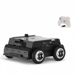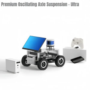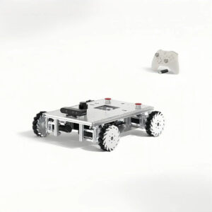
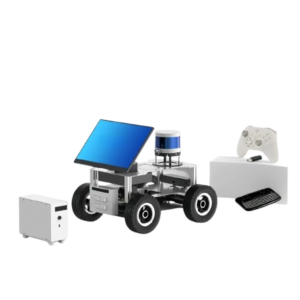
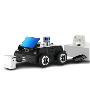
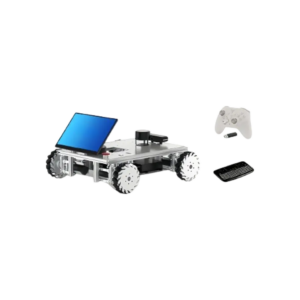
LSR200Auto ROS2 Autonomous Driving Platform with 4WD Hub Motors, 16-line LiDAR, RTK GNSS and Autoware.Universe-Orin NX Super – (Ultra)

$13,966.00

Description

  • High-performance autonomous driving platform based on ROS2 and Autoware.Universe, integrating localization, mapping, perception, planning and vehicle control for self-driving research and rapid development.
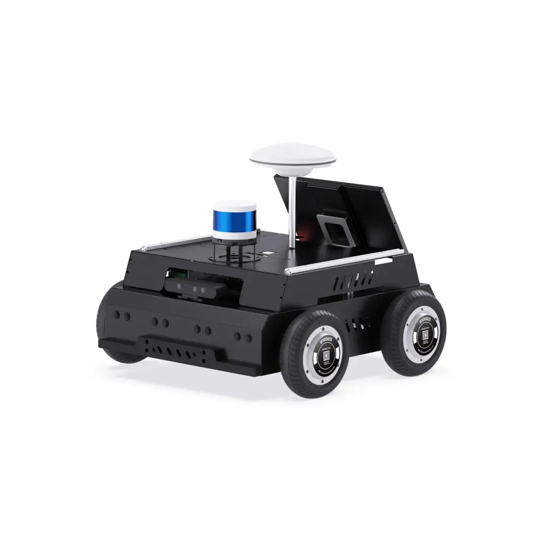
  • Powerful 4WD chassis featuring four 8-inch brushless hub motors and independent suspension, delivering smooth motion, excellent terrain adaptability and outstanding outdoor mobility.
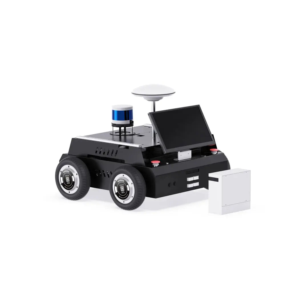
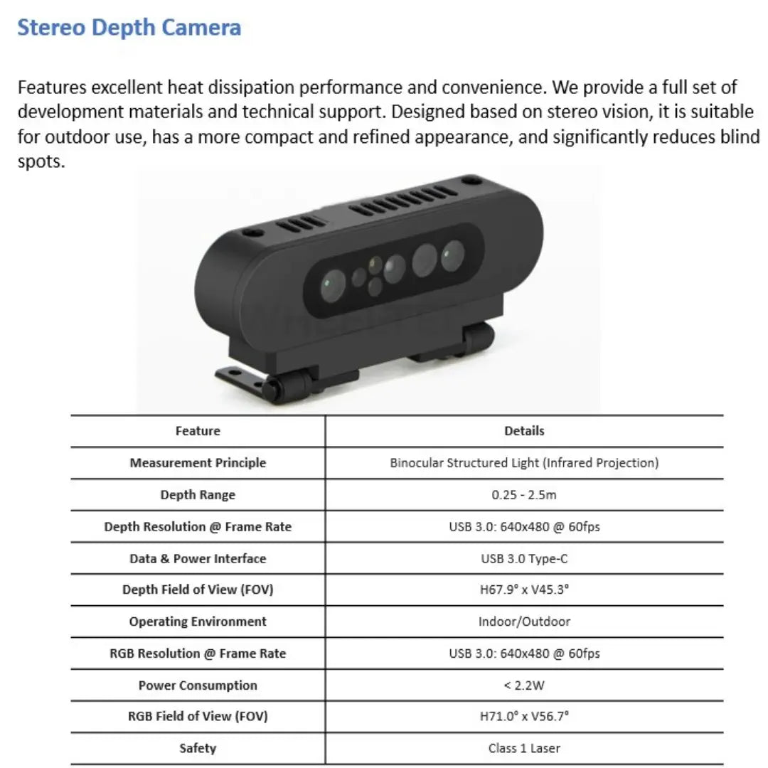
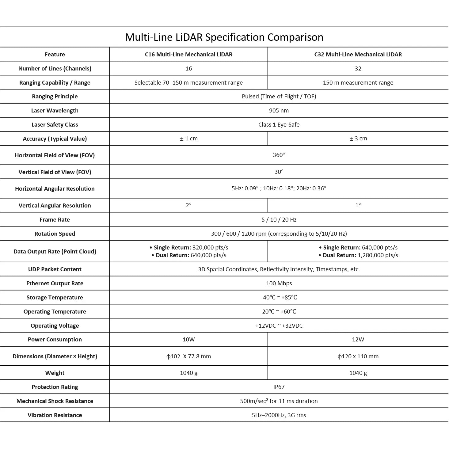
  • Comprehensive multi-sensor fusion system including a 16-channel LiDAR, stereo depth camera, 77 GHz millimeter-wave radar, RTK GNSS and high-precision 9-axis IMU for accurate perception and localization.
  • Designed for outdoor 3D mapping and autonomous navigation, making it ideal for campus patrol, last-mile delivery, inspection and autonomous driving applications.
  • Fully open-source platform with ROS2 tutorials, source code, CAD models, schematics and documentation, enabling efficient secondary development and algorithm research.

LSR200Auto is a ROS2-based autonomous driving platform developed for robotics research, autonomous vehicle development and intelligent mobility applications. Powered by the Autoware.Universe framework, the system provides a complete autonomous driving stack including localization, mapping, object detection and tracking, mission planning, motion planning and vehicle control, allowing researchers and developers to rapidly build and validate self-driving technologies.

The platform adopts a high-performance four-wheel-drive architecture with four 8-inch brushless hub motors and an independent suspension system. Combining strong traction, smooth control and excellent terrain adaptability, the robot is capable of operating reliably on both indoor and outdoor paved surfaces. Its industrial-grade enclosure and elevated expansion layer provide ample space for sensors and computing hardware, while the integrated 20,000 mAh battery supports long-duration operation.

To achieve robust environmental perception, the LSR200Auto integrates a comprehensive sensor suite consisting of a 16-line LiDAR, stereo depth camera, MR20 77 GHz millimeter-wave radar, RTK GNSS module and a high-precision H30 9-axis IMU. The 16-channel LiDAR delivers 360° sensing with ±3 cm accuracy, while the GNSS module supports RTK differential positioning through a 4G network for highly accurate outdoor localization. The industrial-grade IMU further enhances motion estimation through advanced sensor fusion algorithms.

The platform also incorporates six ultrasonic sensors—four at the front and two at the rear—to eliminate blind spots that cannot be detected by LiDAR, improving obstacle avoidance performance and operational safety.

Supporting outdoor 3D reconstruction and autonomous navigation under ROS2, the LSR200Auto is well suited for applications such as campus patrol, last-mile delivery, intelligent inspection and autonomous driving research.

To accelerate development, the entire system is fully open source and includes source code, 3D CAD models, schematics, development manuals and ROS2 tutorials. The LSR200Auto provides a powerful yet cost-effective platform for universities, research institutes and developers seeking a professional autonomous driving research vehicle.

1x ROS controller Orin NX Super (16GB)

1x Chassis(Independent Suspension)

1x Stereo Depth Camera

1x 16-line LiDAR(Upgradeable to a 32-line LiDAR.)

1 × mmWave Radar

6x Waterproof Ultrasonic Sensors

1 × H30 9-Axis IMU

1 × G70 RTK GNSS Module

1x Touchscreen

1x Auto-Recharging

1x Smart Speaker

1x Multi-mode Joystick

1x Keyboard

Fully Open Source

Note:Please contact the seller for customized or upgraded configurations.

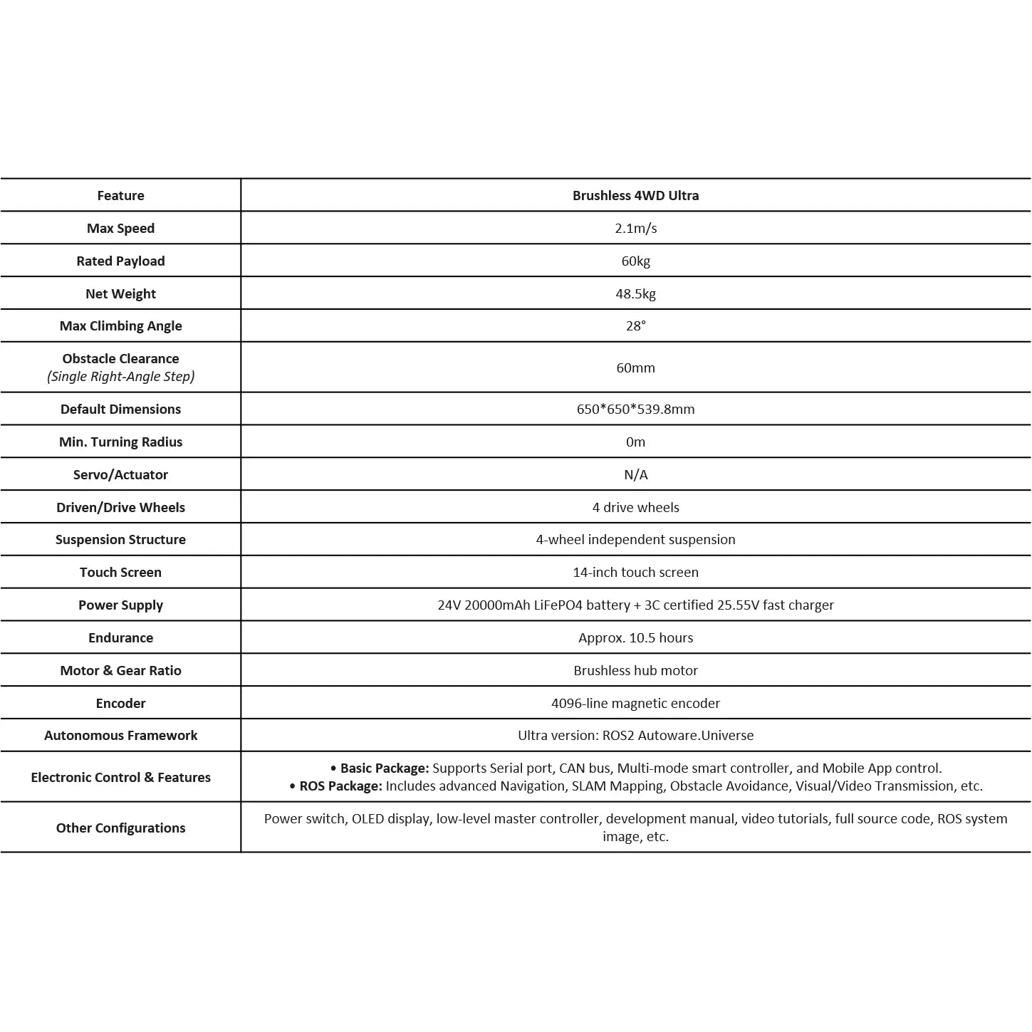
Chassis Dimensions:650 × 650 × 539.8 mm

Net Weight : 48.5kg

Payload Capacity : 60kg

1. SLAM & Mapping

RTAB-Map 3D VSLAM (vision-only & LiDAR-vision fusion)

ORB-SLAM2 visual SLAM with RGB-D metric reconstruction

2D LiDAR SLAM: Gmapping, Cartographer, slam_toolbox (ROS2), Hector, Karto (ROS1)

LiDAR angle masking / sector filtering for optimized perception

Real-time 3D environment reconstruction and mapping

2. Autonomous Navigation & Planning

ROS2 Nav2 autonomous navigation framework

Multi-point waypoint navigation & path recording/playback

RRT-based autonomous exploration and mapping

Coverage path planning for full-area traversal

TEB, DWA navigation planners

DWB, MPPI, RPP motion controllers (multi-scenario support)

3. Perception & Computer Vision

YOLO-based object detection (v3 / v8 / v11 depending on ROS version)

Gesture recognition and general object detection

AR tag detection and 6-DOF pose tracking

Depth-based target following and real-time distance estimation

RGB line following with LiDAR-assisted obstacle avoidance

KCF visual target tracking

LiDAR-based dynamic target following

4. AI & Human–Robot Interaction

LLM deployment (local edge or cloud-based)

Text-to-Speech (TTS) voice interaction system

iFLYTEK-compatible voice dialogue expansion

Web-based camera live streaming and monitoring

ROS mobile APP for navigation control

Android / iOS tuning APP with real-time parameter adjustment

5. System Software & ROS Ecosystem

Fully compatible with ROS 1 and ROS 2

Autoware.Universe integration support (selected platforms)

QT-based ROS graphical control interface (one-click launch system)

Python-based tutorials and simulation-style learning tools

Pre-configured navigation and perception demo pipelines

6. Motion Control & Vehicle Dynamics

Ackermann / differential / tracked / mecanum / omnidirectional kinematics support

Path planning controllers: DWB, MPPI, RPP

Motion trajectory recording and autonomous playback

Real-time velocity, battery, and system status monitoring via GUI

7. Sensors & Localization

Multi-line LiDAR support for 2D/3D mapping and navigation

RGB-D depth camera integration

GNSS positioning with RTK differential correction

IMU-assisted fusion localization (9-axis or equivalent)

GNSS-based initial pose setting and map re-localization (NDT matching support)

8. Development & Expandability

Fully open-source system (hardware + software)

Includes 3D CAD models, source code, schematics, and documentation

Bluetooth wireless code flashing for rapid debugging

Modular SDK for LiDAR configuration and sensor customization

Supports secondary development and algorithm integration

9. Advanced Autonomous Driving Features

Autoware.Universe multi-point autonomous driving routines

Outdoor 3D reconstruction with multi-line LiDAR upgrade

End-to-end autonomous driving stack (perception → planning → control)

Campus / park / logistics route autonomous navigation support
Reviews

There are no reviews yet.

Be the first to review “LSR200Auto ROS2 Autonomous Driving Platform with 4WD Hub Motors, 16-line LiDAR, RTK GNSS and Autoware.Universe-Orin NX Super – (Ultra)”

Your email address will not be published. Required fields are marked *